Category:Maps: Difference between revisions
From AlanMacek.com Canyon
No edit summary |
m (+images) |
||
| Line 1: | Line 1: | ||
The following are maps: | The following are maps: | ||
[[Category:Images|Maps]] | |||
Latest revision as of 15:38, 22 February 2005
The following are maps:
Media in category "Maps"
The following 16 files are in this category, out of 16 total.
-
CanadianNationalRailwayNetworkMap.png 462 × 320; 15 KB
-
CanadianPacificRailwayNetworkMap.png 444 × 309; 56 KB
-
Craigellachie BC Canada Location.png 246 × 187; 5 KB
-
FraserRiverBritishColumbia Location.png 458 × 339; 14 KB
-
MapOfSouthernBritishColumbia.png 702 × 405; 21 KB
-
NicolaMerrittMap.png 887 × 618; 81 KB
-
Survey1871.png 702 × 405; 18 KB
-
Survey1872.png 702 × 405; 18 KB
-
Survey1873.png 702 × 405; 17 KB
-
Survey1874.png 702 × 405; 19 KB
-
Survey1875.png 702 × 405; 18 KB
-
Survey1876.png 702 × 405; 18 KB
-
Surveys.swf ; 1.04 MB
-
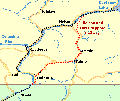
NelsonAndFortSheppardRailway.png 321 × 272; 10 KB
-
Revelstoke BC Canada Location.png 251 × 191; 7 KB
-
ThompsonRiverBritishColumbia Location.png 453 × 340; 29 KB


